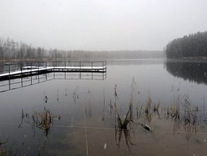
Principles of lake and shoreline surveying
 A comprehensive waterbody survey includes:
- analysis of the water area and bottom profile;
- description of the shoreline, boundaries of the waterbody, water protection zones, and coastal protective belts;
- study of flora, algae, and macrophytes;
- description of fauna and aquatic organisms (hydrobionts);
- assessment of the degree of anthropogenic impact.
The nature of anthropogenic pressure—agriculture, urban development, recreation, discharges, and surface runoff—directly determines the scope and type of biological reclamation measures required for the waterbody and adjacent areas.
Special attention is given to surveys of waterbodies located within protected areas such as parks, nature reserves, and wildlife sanctuaries. Protected waterbodies with restricted public access require special procedures and permits for survey work. The main research methods—hydrochemical analysis and studies of flora and fauna—generally do not significantly affect protection regimes but must be carried out by specialists with appropriate qualifications.
In cases of near-complete degradation of a waterbody—total siltation, overgrowth, and a sharp reduction in open-water area—the primary task becomes mechanical removal of vegetation and bottom sediments. In all other situations—where the ecosystem is preserved, or in cases of construction, landscaping, or fisheries use—scientific investigation is fundamentally necessary.
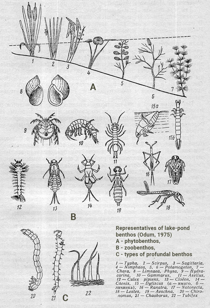
Macrophytes as the ecological foundation of a lake
Higher aquatic vegetation includes macrophytes—large aquatic plants, including flowering plants and some large algae, inhabiting the littoral zone and the bottom of waterbodies.
Macrophytes:
- absorb nutrients entering from the catchment;
- reduce the intensity of algal blooms;
- stabilize bottom sediments;
- form natural biological filters;
- provide shelter and spawning grounds for fish;
- create habitats for plankton, larvae, and microorganisms.
As plants die off, they form silt and sapropel, which act as accumulators of organic matter and contribute to the fertility of bottom sediments.
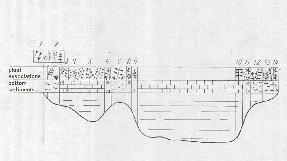
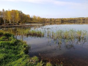
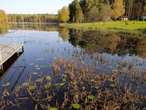
Facies and zonation of aquatic vegetation
Aquatic plants in a lake do not grow randomly but form belts parallel to the shoreline. These zones are referred to as facies—areas characterized by a homogeneous composition of macrophytes and a specific type of bottom substrate. The term is borrowed from geology and ecology and reflects the structural organization of the landscape.
The distribution of facies is determined by:
- water depth;
- transparency and chemical composition of water;
- type of bottom sediments;
- wave exposure;
- shape and origin of the lake (glacial, karst, etc.).
Most glacial lakes exhibit well-defined vegetation and substrate belts, allowing the creation of profile maps and analysis of waterbody development dynamics.
Main belts of aquatic vegetation
-
Littoral Wetland Zone
A shallow zone at the water’s edge with sweet flag (Acorus), sedges (Carex), marsh marigold (Caltha), arrowhead (Sagittaria), and buttercups (Ranunculus). This zone is the first to receive surface runoff and plays a key role in biological water purification.
-
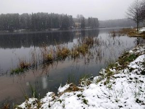
Emergent and Semi-Submerged Plants
Located at depths of up to 1–2 m. Reeds dominate on sandy substrates, while bulrush and sweet grass prevail on silty soils. This belt forms a “second shoreline” and protects the water area from wave action.
-
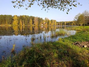
Floating-Leaved Plants
Water lilies (Nymphaea), yellow water lily (Nuphar), floating pondweeds (Potamogeton spp.), and duckweed (Lemna). These plants create calm zones and serve as indicators of a healthy waterbody. Many species are legally protected.
-
Fully Submerged Plants
Pondweeds, Elodea, hornwort (Ceratophyllum), water milfoil (Myriophyllum), and charophyte algae. In clear waterbodies, these plants may grow at depths of up to 7–8 m.
Relationship between vegetation and bottom sediments
The type of bottom substrate directly determines the structure of plant communities:
- sand and gravel — vegetation-poor areas;
- silty substrates — the most productive zones;
- carbonate silts — areas dominated by charophyte algae;
- peat substrates — weakly overgrown areas.
This explains the differences between lakes that may appear similar at first glance.
Flora, fauna of a water bodies and biological productivity
The study of macrophytes is inseparable from the assessment of fauna. Plant communities form the food base, shelters, and spawning grounds for fish and invertebrates.
Of particular importance are:
- mollusks (e.g., freshwater pearl mussels), which are indicators of waterbody health;
- invertebrates, forming the foundation of aquatic food webs;
- fish, which regulate insect populations, including mosquitoes.
Under conditions of global warming, entomological analysis and the development of anti-epidemic measures (West Nile fever, malaria, Zika virus, etc.) become mandatory components of waterbody surveys, especially in southern, subtropical, and sharply continental regions.
Lake overgrowth and the role of humans
Overgrowth of waterbodies is a natural process that unfolds over thousands of years:
- oligotrophic lakes;
- mesotrophic lakes;
- eutrophic lakes;
- paludifying (bog-forming) stages.
Anthropogenic impact dramatically accelerates these stages. Understanding the current developmental stage of a waterbody allows for the selection of appropriate and environmentally safe intervention methods. Waterbody restoration may involve sediment removal and bottom deepening, or may be limited to the removal of debris and woody or plant residues.
Substantiation of hydromelioration and cleaning measures
Based on comprehensive surveys, recommendations and action plans are developed, including:
- selective bottom cleaning;
- regulation of macrophyte vegetation;
- strengthening of water protection zone functions;
- reduction of nutrient (biogenic) inflow;
- biological and, where disease vectors are detected, chemical control of insect populations;
- enhancement of fisheries and recreational value of the waterbody.
Waterbody cleaning is viewed not as a one-time action but as part of an integrated system of reducing anthropogenic pressure and implementing ecological management.
Aquatic vegetation and fauna are key indicators of lake condition. A well-designed survey not only enables effective cleaning but also extends the lifespan of a waterbody, increases its productivity, and preserves natural balance.
Our services in water bodies surveys
We provide comprehensive waterbody surveys, prepare reports and recommendations, and develop solutions for cleaning, reclamation, and environmental support.
Cost of waterbody surveys
The cost of surveying a waterbody—lake, river, oxbow lake, or impoundment—is determined by the scope of work specified in the contract or technical assignment.
The cost of an on-site waterbody survey may include:
- geodetic and bathymetric surveying;
- express diagnostics of water and sediment parameters and laboratory analysis costs;
- work of biologists, entomologists, and botanists involved in surveying flora and fauna, including laboratory analyses;
- ichthyological studies involving specialists, determination of species composition and health indicators of fish fauna;
- entomological monitoring of blood-feeding mosquitoes Aedes aegypti and Aedes albopictus, as well as assessment of Culex spp. populations (common house mosquitoes), whose breeding sites are located in populated areas;
- shoreline surveys with vegetation characterization, preparation of dendrological plans, and tree inventory records;
- on-site delineation of water protection zone boundaries and surveys conducted in accordance with the technical assignment;
- travel expenses, transportation of equipment and instruments;
- preparation of maps, reports, registers, and project documentation, where such follow-up work is envisaged.
Contact us to arrange a waterbody survey.
Contact us if waterbody cleaning and restoration are required.